Ossabaw Island: Of Oceans And Oaks
There are places that seem fixed on a map, and there are places that remind us that land is always moving. Ossabaw Island belongs to the latter.
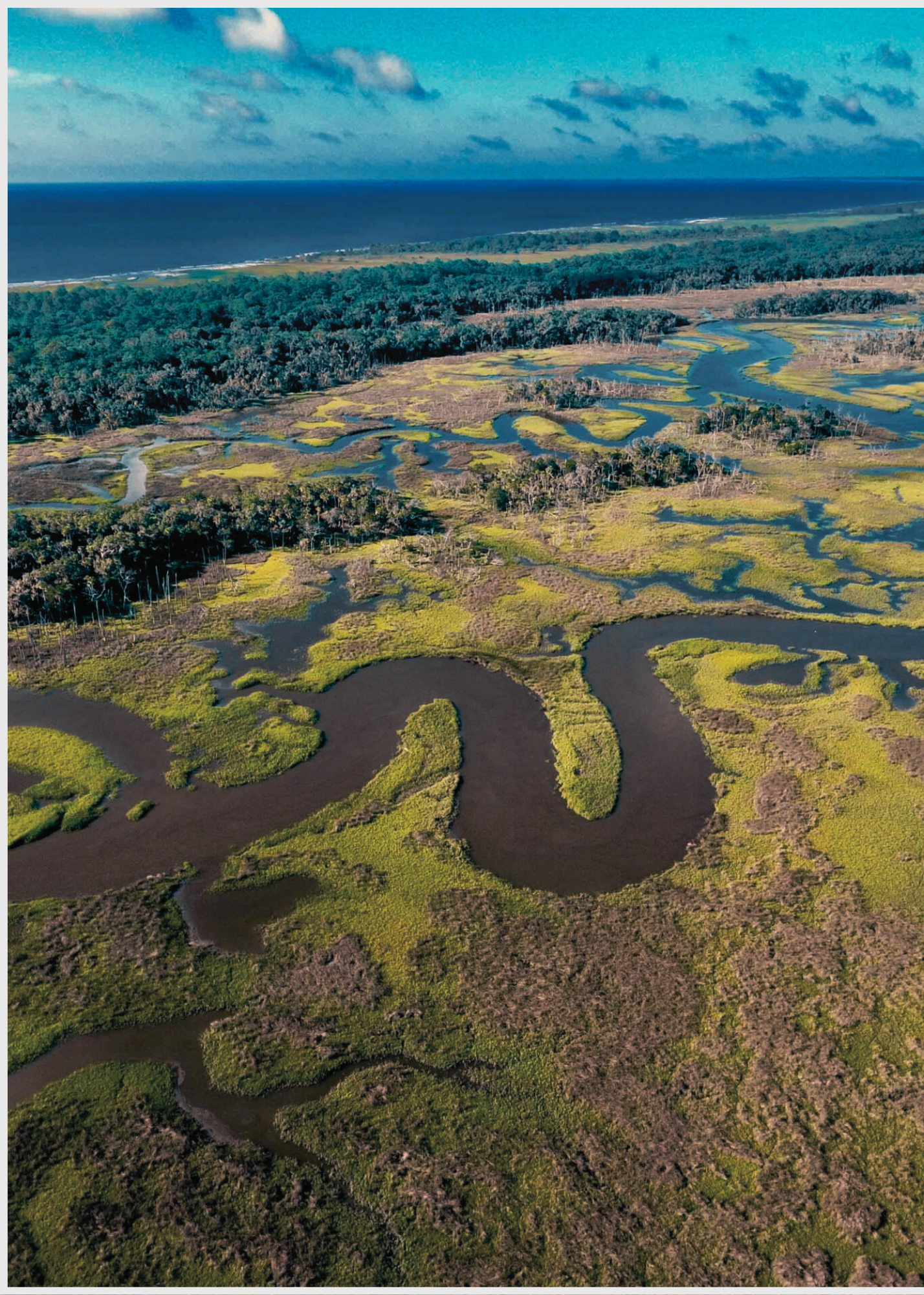
From above, the island appears suspended between land and sea. Creeks curl through salt marshes. Forests gather across the higher ground. Long stretches of sand meet the Atlantic. Water enters, retreats, divides, reconnects, and slowly reshapes the edges.
Located along the Georgia coast about 30 minutes south of Savannah, Ossabaw is approximately 26,000 acres and is Georgia's third-largest barrier island. Nearly 9,000 acres are high ground, while much of the remaining landscape consists of tidal wetlands. The island stretches roughly ten miles from north to south and reaches about seven miles across at its widest point. The Atlantic Ocean forms its eastern edge, with the Ogeechee River and Ossabaw Sound to the north, St. Catherine's Sound to the south, and the Bear River and Florida Passage along the west.
An Island Shaped by Water
Ossabaw is a barrier island, and water is one of its great architects. Tides move continually through the surrounding sounds, rivers, marshes, and winding tidal creeks. Sand shifts. Shorelines erode and rebuild. Marshes flood and drain. The meeting of salt water, fresh water, sediment, vegetation, wind, and time creates a landscape that is constantly responding to the forces around it.
Even the island's geology tells a story of change. Ossabaw's central high ground dates to the Pleistocene, roughly 40,000 to 50,000 years ago, while the steep parallel dune ridges on the eastern side are considerably younger, having formed during the Holocene less than 4,000 years ago.
One island holds landscapes separated by tens of thousands of years. That sense of movement through time became the beginning of my interpretation of Ossabaw. Rather than painting the island as a static piece of land surrounded by water, I wanted the painting to feel as though the landscape were still forming.
Forest, Marsh, Beach and Creek
Ossabaw contains a remarkable range of coastal ecosystems. Its approximately 9,000 upland acres include maritime forests, meadows, and wetlands. Beyond the high ground stretch roughly 17,000 acres of salt marsh, while about 13 miles of undeveloped, dune-lined beach face the Atlantic.
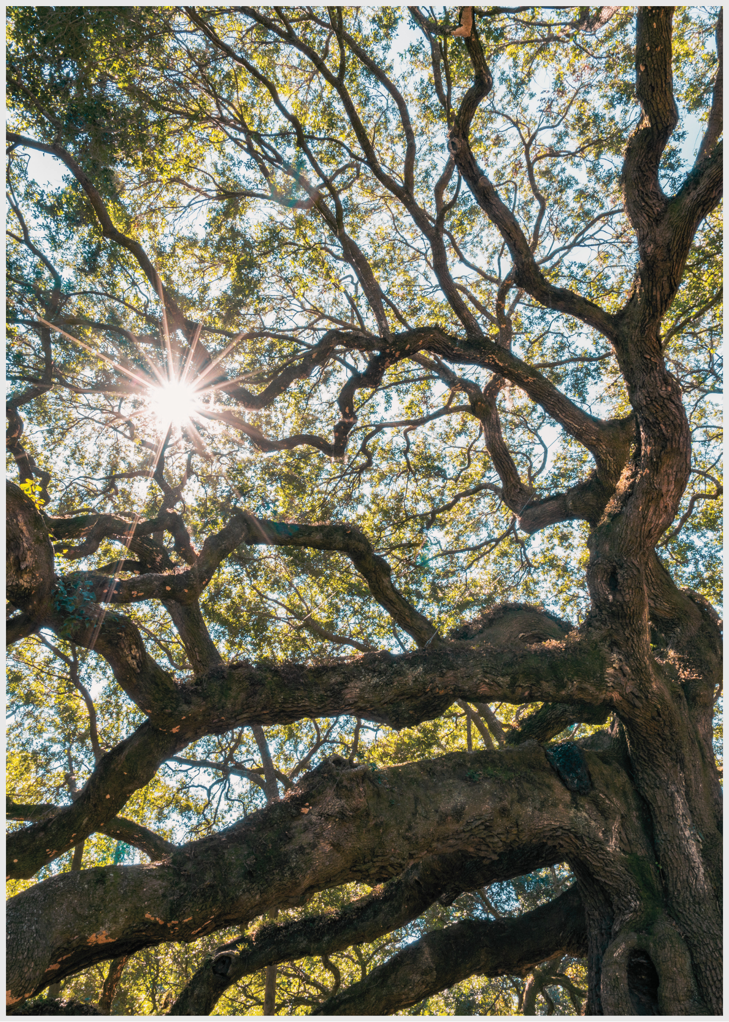
The maritime forest is filled with live oaks, southern magnolias, hollies, dogwoods, cabbage palms, palmettos, red cedar, and several varieties of pine. Much of the forest seen today is secondary growth. During the eighteenth and nineteenth centuries, live oak and red cedar were harvested from Ossabaw for shipbuilding, leaving another human imprint within what can initially appear to be untouched wilderness.
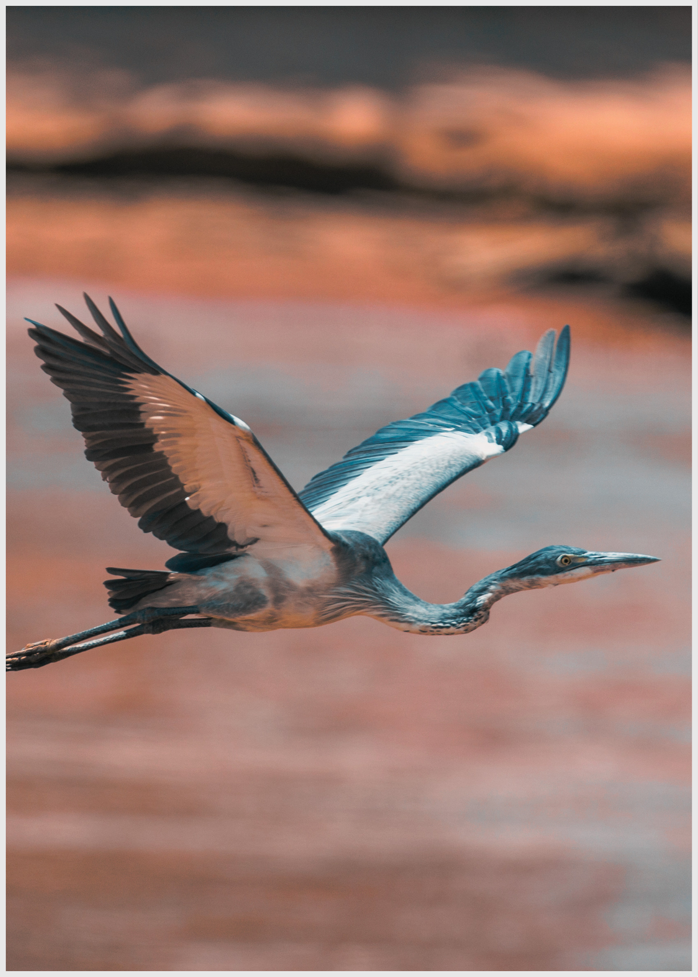
Then the forest gives way to marsh. Tidal creeks branch through grasses in forms that can look almost like veins when seen from above. These salt marshes and creeks are productive nursery grounds for fish and shellfish, which in turn support egrets, herons, ibis, wood storks, waterfowl, and other resident and migratory birds.
Ossabaw's forests provide another kind of refuge. The island supports species ranging from the endangered red-cockaded woodpecker to painted buntings, while its beaches provide important nesting habitat for endangered loggerhead sea turtles. The island is also home to animals that have become part of its contemporary character, including pigs and free-ranging donkeys.
Every terrain supports something different. That diversity became part of the language of the painting.
A Landscape Holding Thousands of Years
Ossabaw's natural history is only one layer of its story. People have lived on and moved through this landscape for thousands of years. Archaeological evidence on Ossabaw reaches back roughly 5,000 years. Indigenous people first occupied the island seasonally and later established more permanent settlements. The island contains hundreds of Native archaeological sites, preserving evidence of generations who hunted, fished, gathered, farmed, and built communities within this coastal environment.
During the sixteenth and seventeenth centuries, Ossabaw existed within the world of the Guale people and Spanish colonial expansion along the Georgia coast. Archaeologists have found Spanish pottery fragments at several sites on the island, evidence of contact during this period.
In 1733, Ossabaw and neighboring barrier islands were set aside as hunting and fishing reserves for Creek people. In 1747, ownership of Ossabaw, Sapelo, and St. Catherines was transferred to Mary Musgrove and her husband, Thomas Bosomworth. Musgrove played an important role as an interpreter and cultural intermediary between Georgia's English colonists and Native communities. Ownership of the island later passed into other hands as colonial settlement expanded.
John Morel Sr. established a plantation on Ossabaw's North End by 1763. Enslaved Africans cultivated indigo and Sea Island cotton, tended livestock, harvested timber, and participated in maritime construction. Their labor became part of both the physical and cultural landscape of the island.
Following the Civil War, a community of freed African Americans remained on Ossabaw. In the 1880 census, the island's population numbered 180 people, most or all of whom were African American. Over time, many of these Gullah-Geechee residents moved to the mainland, particularly as hurricanes struck the coast during the late nineteenth century. Some became part of communities such as nearby Pin Point, carrying with them traditions and family histories rooted in the Sea Islands.
Ossabaw's modern story took another important turn in 1978. When the Torrey and West families sold the island to the State of Georgia, its Heritage Preserve designation became a condition of the sale. On June 15, 1978, Governor George Busbee formally designated Ossabaw Island as a Heritage Preserve, establishing that its natural and cultural resources would be protected and that the island would be used for natural, scientific, and cultural study, research, education, preservation, and conservation.
Today, the Georgia Department of Natural Resources and the Ossabaw Island Foundation share responsibility for its stewardship. Access remains carefully managed, and visitors must be accompanied by representatives of the Foundation or the Department of Natural Resources.
The island has also become a place of scientific inquiry. Archaeological research dates to at least 1897, and scientists continued studying the island throughout the twentieth century. Beginning in the 1960s, ecologist Eugene Odum studied Ossabaw's salt marshes and freshwater wetlands as part of broader research into coastal ecosystems.
Preserving Ossabaw therefore means more than keeping development away. It allows the island to remain a place where nature, history, science, art, and human experience can continue to meet.
How the Painting Came Together
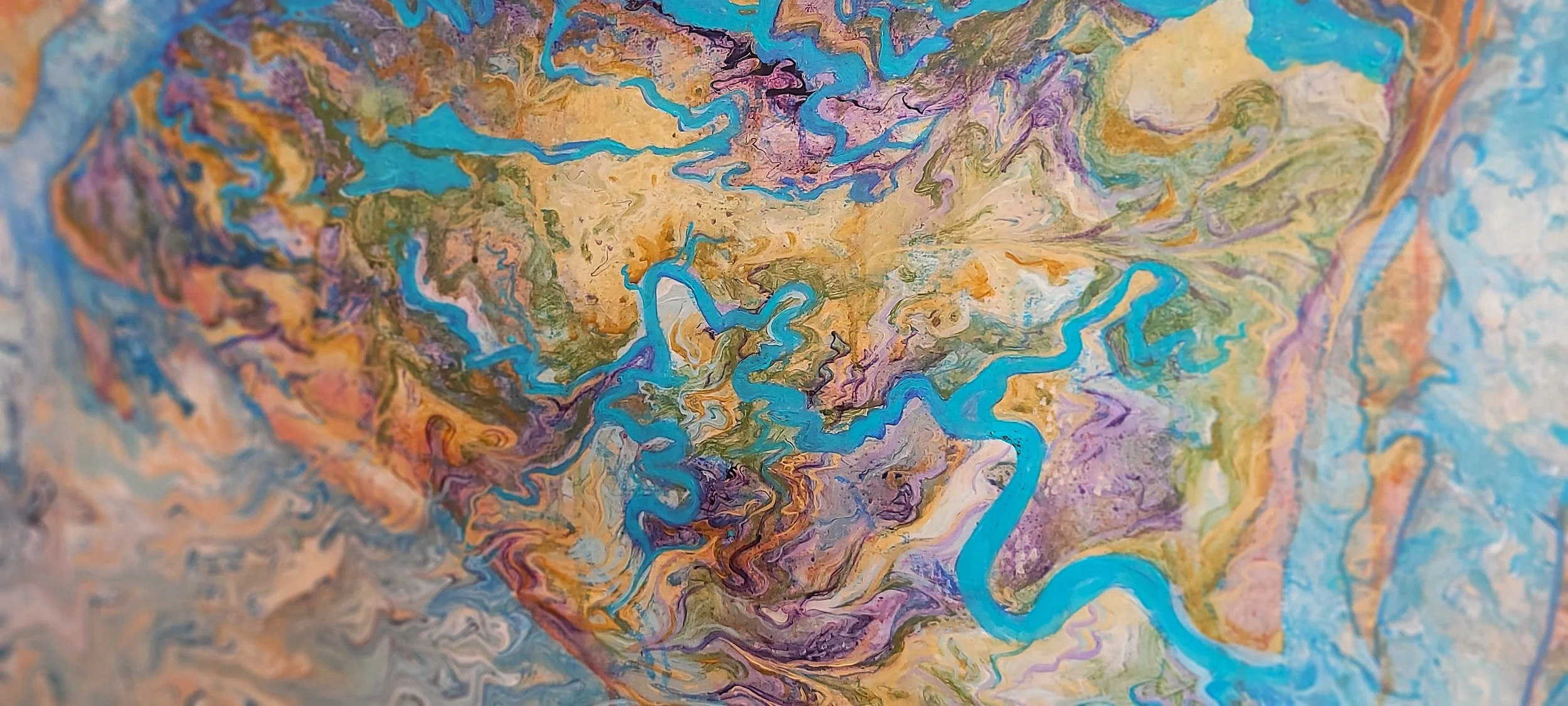
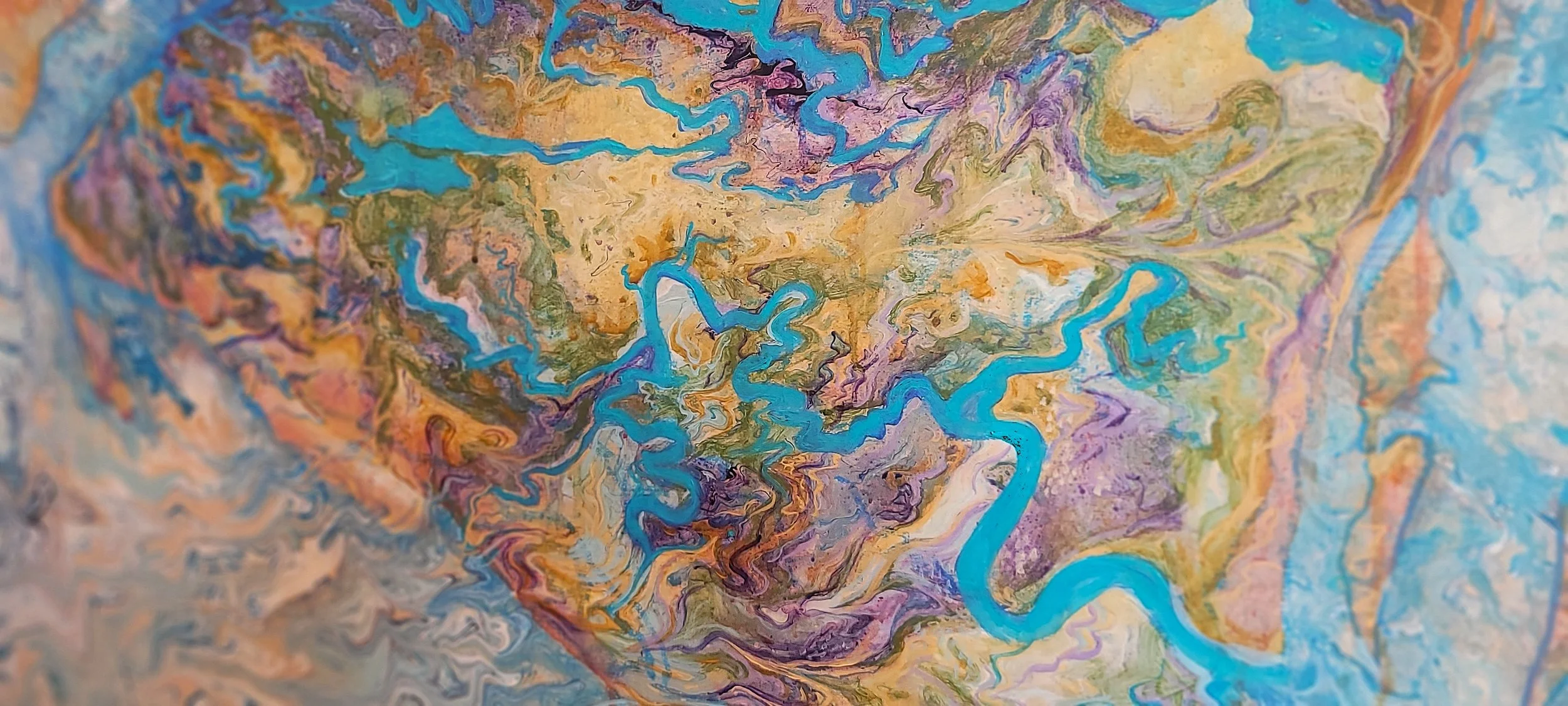
Ossabaw Island : of Oceans and Oaks is currently a work in progress. The painting began with movement. Before defining the recognizable shape of Ossabaw, I created an abstract pour across the surface, allowing the paint to move, merge, separate, pool, and find its own paths. This process became a visual reference to the natural forces that continually shape a barrier island. Tides move in and out, creeks change course, water carries sediment, shorelines erode, sand gathers somewhere else, and marshes flood and emerge again. There is structure within these processes, but there is also an element that cannot be completely controlled. I wanted the first layer of the painting to carry that same feeling of movement and unpredictability.
The colors flowed into one another before the geography was imposed over them. Teals, deep purples, soft pinks, olive greens, and ochre yellows meet and melt across the surface, creating passages that feel geological, watery, and organic. From this movement, the island began to emerge. I glazed the recognizable geography over the abstract pour rather than completely covering it, allowing the underlying colors and gestures to remain visible through the surface. The result is a landscape built from layers, where the abstraction beneath Ossabaw becomes part of the land itself. This decision became central to the meaning of the piece. The map gives the island a recognizable form, while the abstraction underneath suggests everything a conventional map cannot contain—the movement of water, the passage of time, the forces of nature, and the layers of history held within the landscape.
The colors each speak to a different part of Ossabaw's terrain while remaining intentionally abstract. Teal follows the presence of water, moving through the rivers, sounds, tidal creeks, marshes, and Atlantic Ocean that define so much of the island's geography. Olive green belongs to the maritime forest, palmettos, live oaks, grasses, and dense vegetation covering the island's higher ground. Ochre yellow carries the warmth of sand, dunes, exposed earth, sunlight, and the transitional spaces where land meets water. Soft pink introduces the quieter colors found within salt flats, coastal light, vegetation, and sediment, softening the boundaries between ecological zones. Deep purple brings depth into the landscape, suggesting shadow, wet earth, submerged places, accumulated organic material, and the sense of history held beneath the visible island.
Help Bring the Savannah Cartography Series to Life
Become a founding supporter of the Savannah Cartography Series, a new collection of original abstract cartography paintings celebrating the history, ecosystems, and cultural heritage of Savannah, Georgia.
This six-painting collection explores the city's winding waterways, salt marshes, historic neighborhoods, and the stories that have shaped Savannah for nearly three centuries. Beginning with real maps and transformed through layered acrylic textures, each painting reflects the relationship between geography, memory, and identity.
Your contribution directly supports the research, design, and creation of the series, including archival materials, studio time, documentation, and exhibition preparation.
As a thank you for supporting independent art, every contributor will receive behind-the-scenes updates throughout the project, offering a first look at sketches, studio progress, and the stories behind each painting. Higher contribution levels include additional rewards such as limited-edition prints, postcard sets, early access to original works, and collector experiences.
Whether you have called Savannah home for decades, discovered its beauty while traveling, or simply believe in preserving meaningful places through art, your support becomes part of the story behind this collection.
Campaign Goal: $7,900
The Collection
Four original 9 × 12 inch paintings
One original 18 × 24 inch painting
One signature 18 × 36 inch painting of Ossabaw Sound
Together, these works will celebrate Savannah through its rivers, marshes, parks, neighborhoods, and the people whose stories continue to shape the city.
Thank you for helping transform maps into memories and preserving the spirit of Savannah through art.
Please note: This listing represents a crowdfunding contribution to the Savannah Cartography Series. Reward fulfillment and project updates will be provided according to the campaign timeline.
