Rotorua and the Living Landscape
Traveling to Rotorua feels different the moment you arrive.
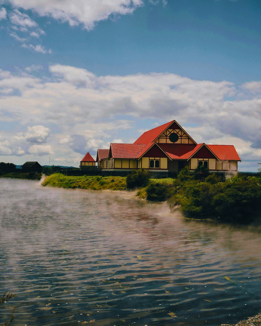
There is a softness in the air, even with the scent of sulfur drifting through town. Steam rises from the ground in unexpected places. Near the lake. Along sidewalks. Beyond fences where the earth quietly simmers.
You notice how close everything feels. Water, forest, geothermal valleys. The redwoods stand tall and steady, while nearby the land bubbles and releases heat from far below. It is a place shaped by forces you cannot see, yet constantly sense.
Mornings arrive with mist hanging low over Lake Rotorua. By afternoon, light catches the steam and turns it luminous. The pace slows without asking you to. You walk more. You look down at the ground more often.
Rotorua is not polished in the way some destinations try to be. It is active. Alive. Layered with history, with Māori culture woven into daily life, not set apart from it.
You leave aware of the earth beneath you. Of how landscapes shape memory long after the trip is over.
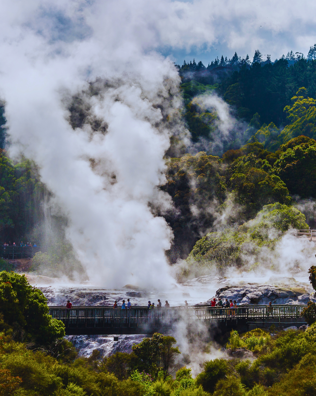
Rotorua reveals itself through heat, water, and story. Steam rises quietly from the ground in unexpected places. Mineral pools glow with unusual color. The scent of sulphur drifts through the air as a reminder that powerful geothermal systems move constantly beneath the surface. Walking through the city, the landscape feels alive, as though the earth itself is breathing.
Rotorua and the Living Landscape
Rotorua sits within one of the most geologically active regions in Aotearoa New Zealand. The city lies along the Taupō Volcanic Zone, where heated groundwater rises through fractures in volcanic rock, forming geysers, hot springs, and bubbling mud pools that define the landscape.
At the center of the city rests Lake Rotorua, a broad volcanic lake whose still surface contrasts with the restless geothermal systems surrounding it. Formed thousands of years ago through volcanic activity, the lake has long served as both a physical and cultural anchor for the communities who live along its shores.
Rotorua is also home to the iwi of Te Arawa, whose ancestral story begins with one of the great ocean voyages of Polynesian exploration. According to oral histories, the waka Te Arawa set out from the homeland of Hawaiki under the leadership of the navigator Tama-te-kapua. The journey across the Pacific was guided by stars, winds, currents, and deep knowledge of the ocean. The canoe eventually made landfall on the coast of Aotearoa and its descendants spread inland, eventually settling around the lakes and geothermal valleys of Rotorua.
The story of the Te Arawa canoe is not only about migration. It forms the foundation of whakapapa, the genealogical connections that link people, land, and ancestors. The canoe itself is remembered as an ancestor. Its journey becomes a narrative of belonging that continues to shape identity and stewardship of the land.
One well known story associated with Te Arawa involves the tohunga Ngātoroirangi, a priest and navigator who traveled inland toward the volcanic peaks of the central North Island. As the story is told, he climbed the slopes of Tongariro and nearly froze in the alpine cold. In desperation he called back to Hawaiki for warmth. His sisters sent sacred fire beneath the earth to reach him. The fire traveled across the land, surfacing in places where the ground split open with geothermal heat. Rotorua’s steaming valleys and hot springs are often connected to this story, the geothermal landscape understood as the pathway of that subterranean fire.
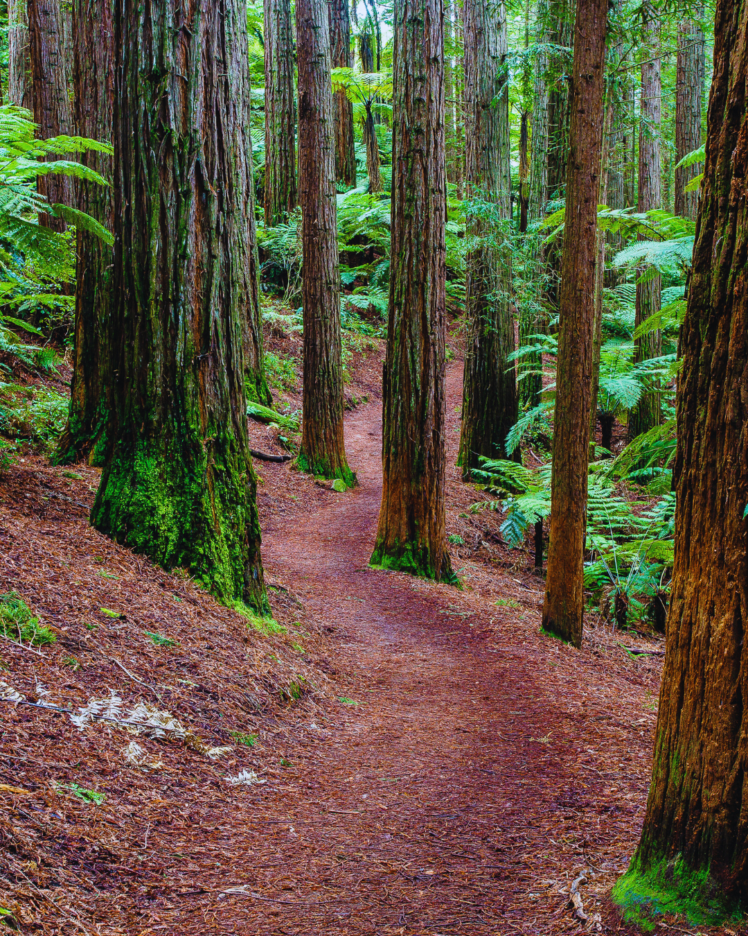
The surrounding forests carry their own history. Just beyond the city lies Whakarewarewa Forest Park, commonly known as the Redwoods Forest. The towering redwood trees that define the landscape today were planted beginning in 1901 as part of a forestry experiment. Officials of the New Zealand Forestry Service were testing whether foreign timber species might grow successfully in the region’s volcanic soils.
Among the many species planted, the Californian coast redwood proved particularly well suited to the environment. Over the following decades, the trees grew into immense vertical columns, some rising more than sixty meters above the forest floor. Their reddish bark and towering scale created an unexpected landscape that feels both ancient and quietly monumental.
Walking through the forest today, the atmosphere shifts dramatically from the geothermal basin nearby. Light filters through layers of towering trunks and high branches, casting cool green shadows across the ground. The volcanic soil supports dense understory ferns and mosses, softening the forest floor. Paths wind between the trees in slow curves, inviting long quiet walks through filtered light and still air.
For the Te Arawa people, the forested landscape surrounding Rotorua has always been part of a wider cultural environment shaped by both natural systems and human care. Even as the redwoods themselves arrived from across the ocean, the land they stand on continues to hold stories, ancestral connections, and the living presence of geothermal forces beneath the soil.
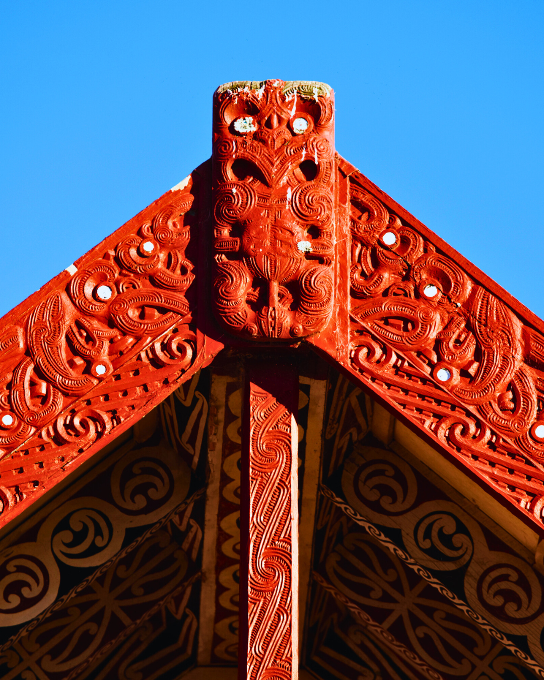
Culture in Rotorua is not confined to museums or preserved spaces. It is practiced daily through carving, weaving, language, ceremony, and performance. Carved meeting houses hold ancestral figures within their structure. Tukutuku panels weave geometric patterns across interior walls. Haka and waiata carry stories through voice and movement.
In many carved figures, the eyes are inlaid with pāua shell, a luminous shell gathered from the ocean. The shell reflects deep blues, greens, and purples that shift with light. Within Māori carving, these eyes give presence to the ancestors represented in the wood. The figures appear watchful and alive, linking past and present within the same space.
Across Rotorua, geothermal activity and cultural life remain intertwined. Steam vents appear beside homes and parks. Cooking pits use natural underground heat. The land itself continues to shape daily experience.
Translating the Landscape Into Abstract Cartography
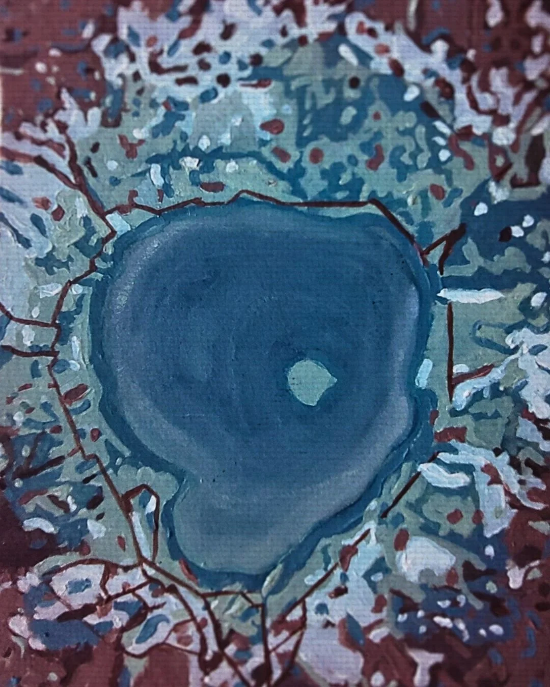
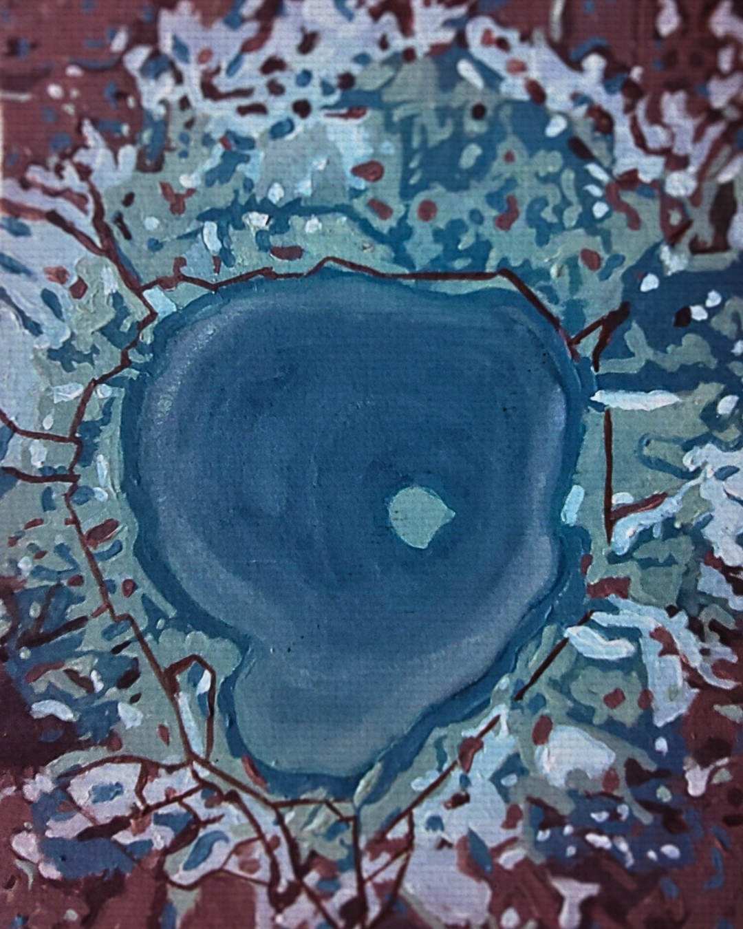
This painting was created as an abstract cartography of Rotorua. Rather than describing the city through literal landmarks, the work maps the sensations of moving through the landscape.
A deep blue form anchors the center of the composition, inspired by the steady presence of Lake Rotorua. From this center, layers of sage green, mineral white, and geothermal red move outward like fractures in the earth’s crust.
Organic lines branch through the surface like geothermal fissures, suggesting the unseen forces beneath the land. Mottled brushwork softens the edges of these lines, echoing drifting steam and the shifting mineral textures found throughout the region.
The palette was influenced partly by the luminous tones of pāua shell used in Māori carving. Subtle blues and iridescent greens move through the composition like quiet reflections, echoing both the shell’s shifting surface and the watery blues of Rotorua’s lakes and geothermal pools.
Collecting the Rotorua Artwork
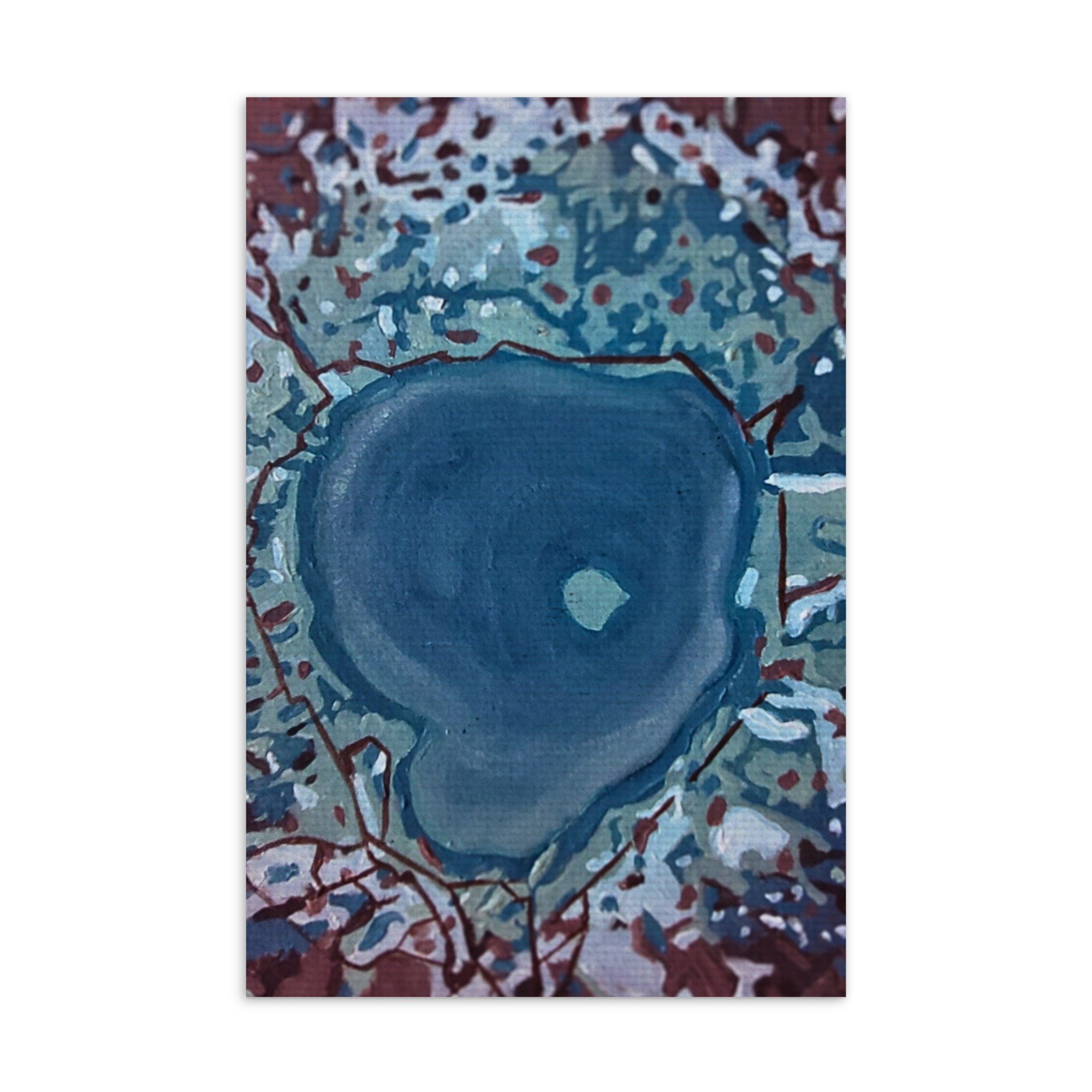
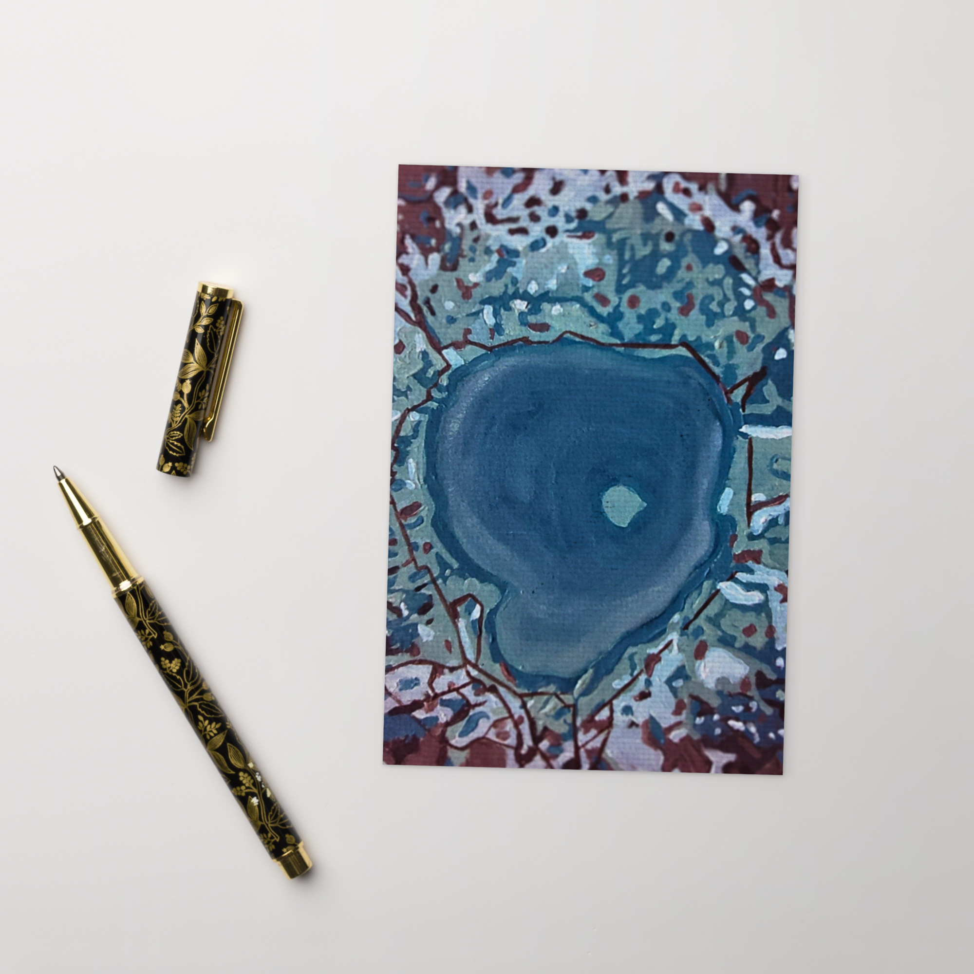
This piece is available as a fine art postcard featuring the Rotorua painting from the Abstract Cartography series by CLR Creations. The series explores meaningful landscapes through layered color, movement, and memory, translating travel experiences into visual maps of place.
• Cardboard paper
• Paper weight: 7.67–10.32 oz/yd² (260–350 g/m²)
• Size: 4″ × 6″ (101 × 152 mm)
• Paper thickness: 0.013″ (0.34 mm)
• Coated outer surface
• Blank product materials sourced from Sweden, US, Brazil, or China
Wai-O-Tapu: Sacred Waters
At Wai-O-Tapu Thermal Wonderland, the ground does not sit still.
Steam rises in slow breaths from the earth.
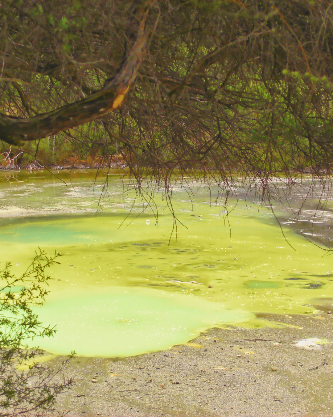
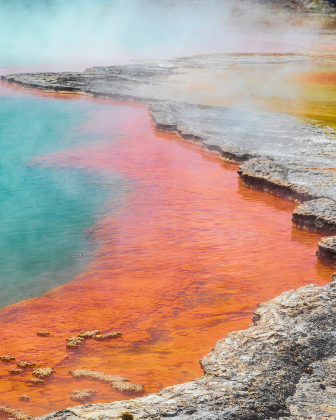
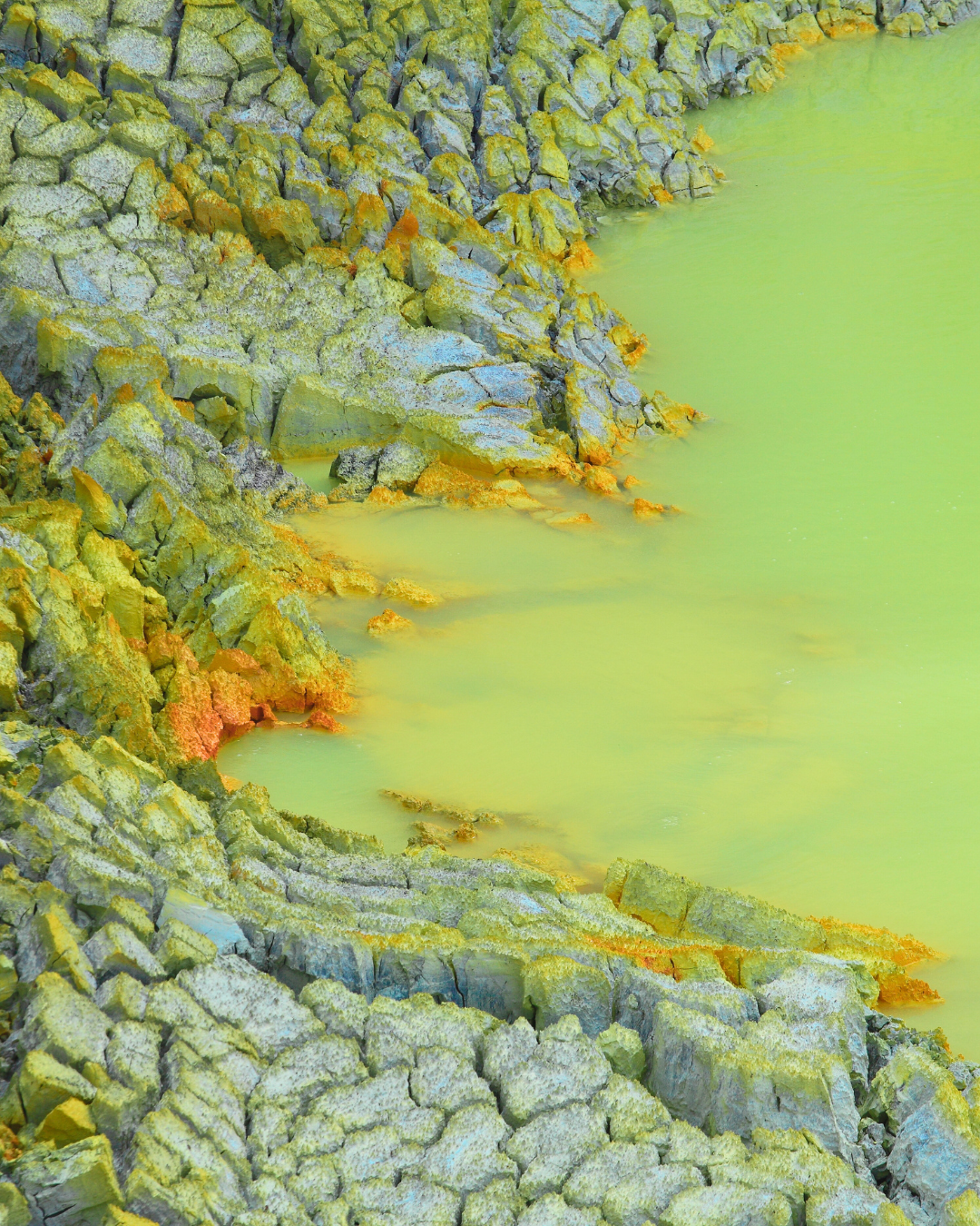
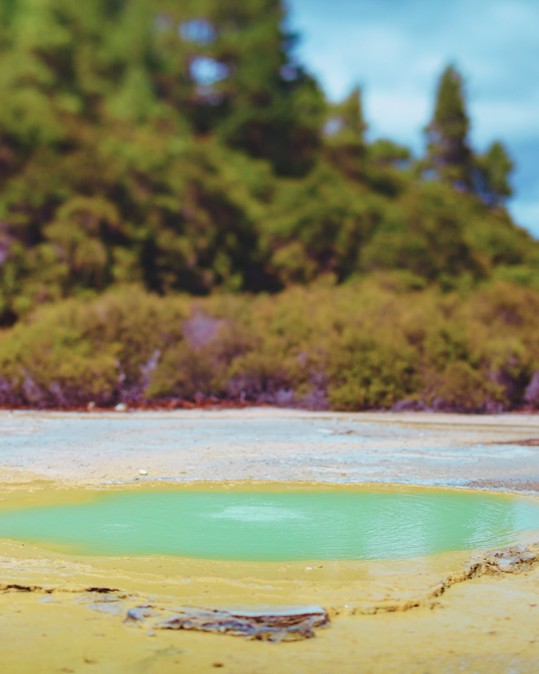
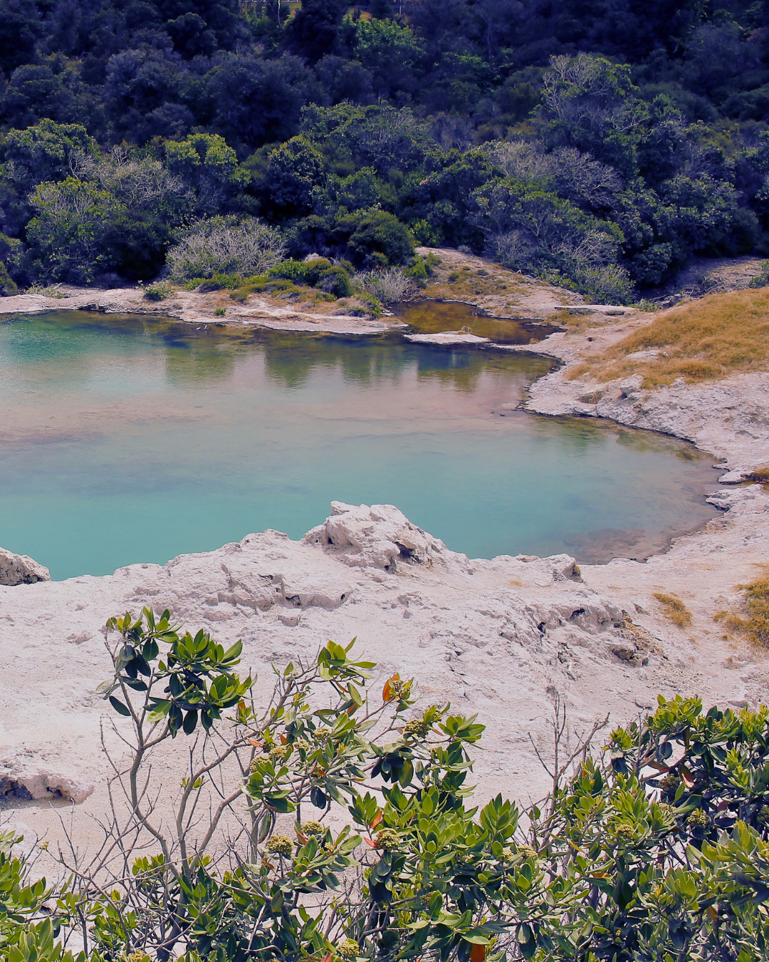
Mineral pools hold colors that feel almost imagined, soft greens, rusted orange, cloudy blue. The air carries the scent of sulfur, sharp but honest. It reminds you that this landscape is active, alive beneath your feet.
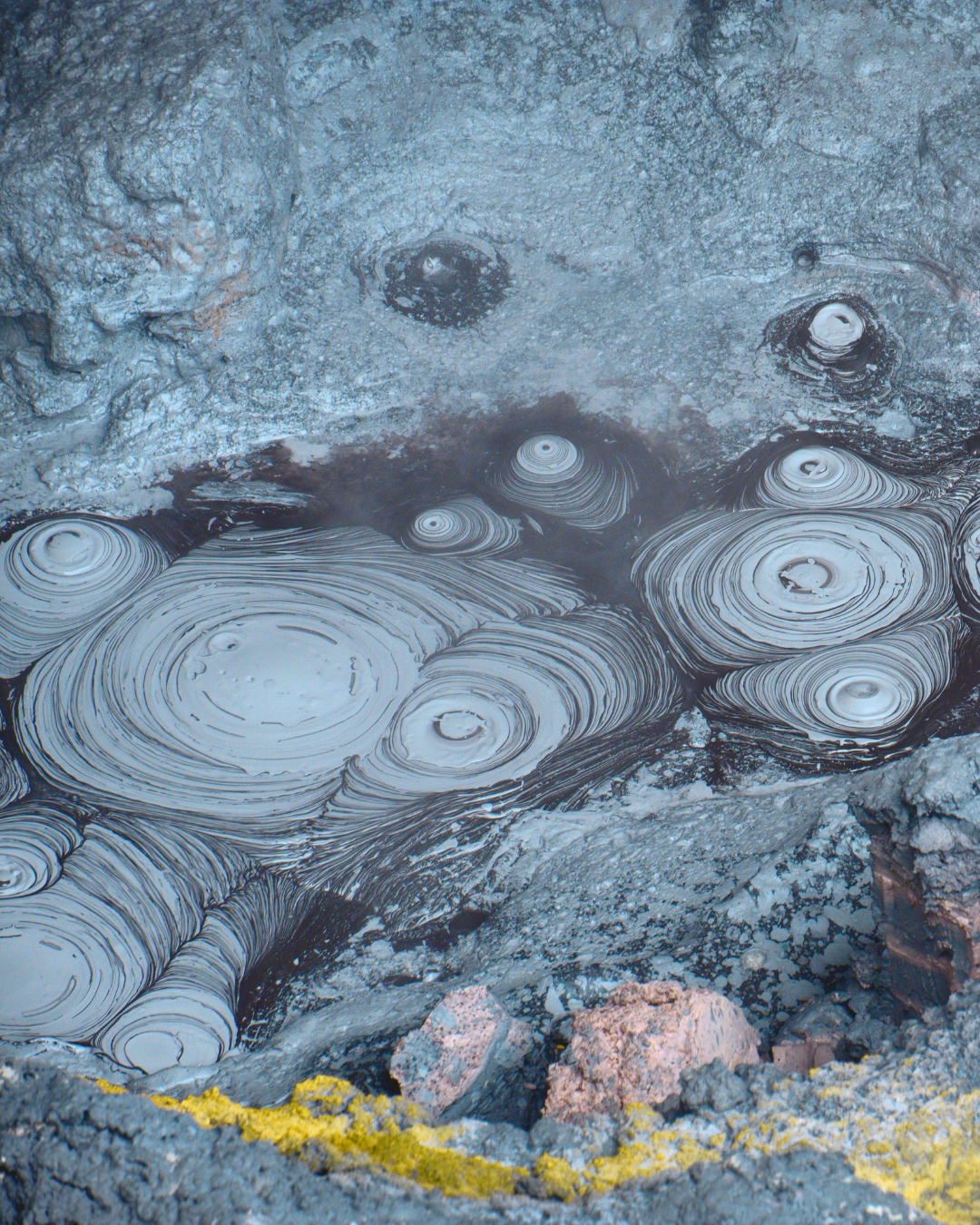
Along the thermal track, the path winds past craters and shifting water. The Champagne Pool rests wide and luminous, its edge traced in bright mineral deposits. Nearby, mud pools fold and release in small bursts, as if the land is thinking out loud.
It is not a place of still surfaces.
Everything here moves, even when it looks calm.
Walking through Wai-o-tapu, you begin to notice how the lines of steam and mineral deposits echo patterns you might later recognize in abstraction. Shapes formed slowly. Colors pulled from deep below. A map written by heat and time rather than roads.
You leave with the sense that the earth has been quietly at work long before you arrived, and will continue long after you’ve gone.
Wai-O-Tapu does not feel like a quiet landscape. The ground breathes. Steam rises from fissures in the earth, mineral pools glow in colors that feel almost impossible, and the air carries the sharp scent of sulphur and warm stone. Walking through this place is less like sightseeing and more like witnessing the earth in motion.
Sacred Waters and the Stories of the Land
The name Wai-O-Tapu comes from te reo Māori. Wai means water and tapu means sacred or forbidden. The name translates simply to sacred waters. Long before the area became a destination for travelers, the geothermal landscape held cultural and spiritual significance for Māori communities, particularly iwi of the Ngāti Tahu-Ngāti Whaoa people who maintain ancestral ties to the region.
Geothermal areas across Rotorua were traditionally used for both daily life and ceremony. Hot pools provided places for bathing and healing. Natural vents allowed food to be cooked directly in the earth. The land was understood not as a spectacle but as a living system shaped by deep forces beneath the surface.
In Māori cosmology, powerful guardian beings called taniwha are believed to inhabit certain waters and landscapes. These stories describe places where the boundary between the visible and unseen world feels thin. In geothermal landscapes like Wai-O-Tapu, rising steam and shifting ground could be read as signs of those unseen presences moving below.
The region also sits within the Taupō Volcanic Zone, one of the most active geothermal systems on the planet. Beneath the vibrant pools lies a vast network of heated groundwater circulating through volcanic rock. As water rises through the earth it carries dissolved minerals that settle into layers of color. Iron creates rusted reds and oranges. Sulphur deposits produce bright yellows. Silica leaves pale mineral terraces that ripple outward from geothermal springs.
The landscape gained wider attention after the eruption of Mount Tarawera in 1886, one of the most powerful volcanic events in New Zealand’s recorded history. That eruption destroyed the famous Pink and White Terraces nearby, which had been considered one of the natural wonders of the world. In the years that followed, scientists and travelers began documenting other geothermal sites across the region, bringing places like Wai-O-Tapu into international awareness.
One of the most curious historical moments tied to the site involves the Lady Knox Geyser. In the early twentieth century, prison workers washing clothes nearby added soap to a hot spring and unexpectedly triggered a dramatic eruption of water. The geyser continues to erupt today when soap is added to the vent, sending water up to twenty meters into the air. It was later named after Constance Knox, daughter of the Governor of New Zealand.
Standing in Wai-O-Tapu today, these layers of story exist together. The land is sacred ground, geological laboratory, and living sculpture formed by heat and mineral time.
Translating the Landscape Into Abstract Cartography
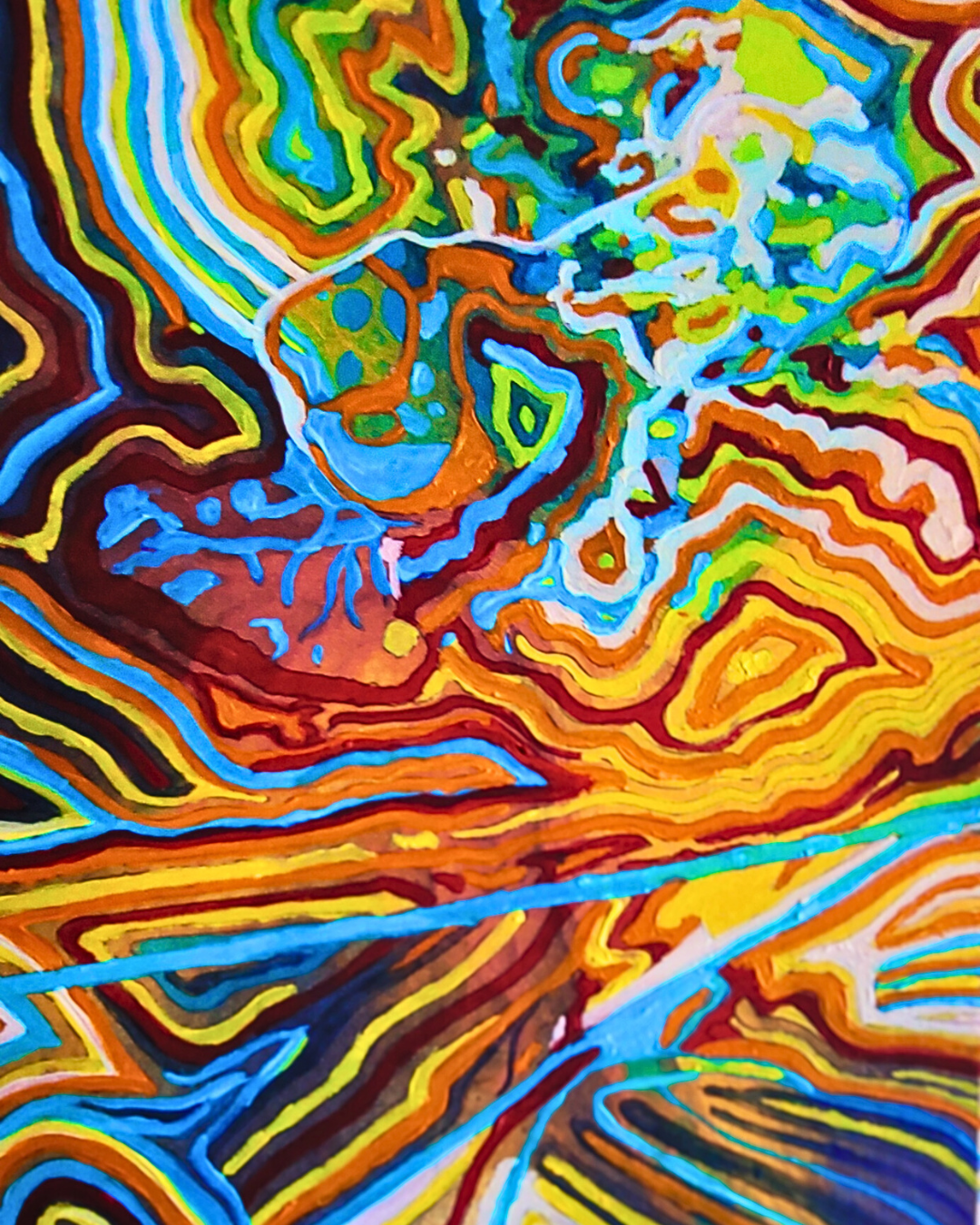
This painting was created as an abstract cartography of that experience. Rather than documenting the site literally, the work maps the sensation of being there.
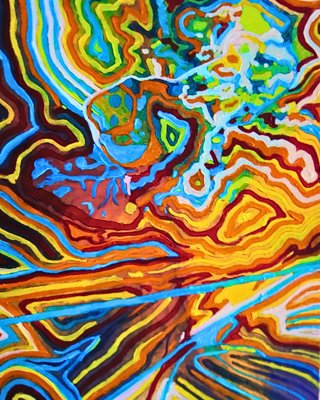
Bands of electric yellow, molten orange, deep oxides, and mineral blues move across the surface like aerial views of thermal basins. Layered contours echo the mineral terraces formed by centuries of geothermal flow. The composition spreads outward from a luminous center, suggesting the quiet gravity of the Champagne Pool and surrounding geothermal formations.
Lines and marks drift across the surface like traces of steam or sediment. They function as pathways through the composition, guiding the eye slowly through areas of heat, color, and quiet stillness. The painting becomes less a representation of geography and more a memory of movement across the land.
In abstract cartography, the goal is not accuracy but resonance. A place is translated through atmosphere, rhythm, and emotional imprint.
Collecting the Wai-O-Tapu Artwork
This piece is available as a fine art postcard featuring the Wai-O-Tapu painting from the Abstract Cartography series by CLR Creations. The series explores meaningful places through layered color, movement, and memory, translating landscapes into visual maps of experience.
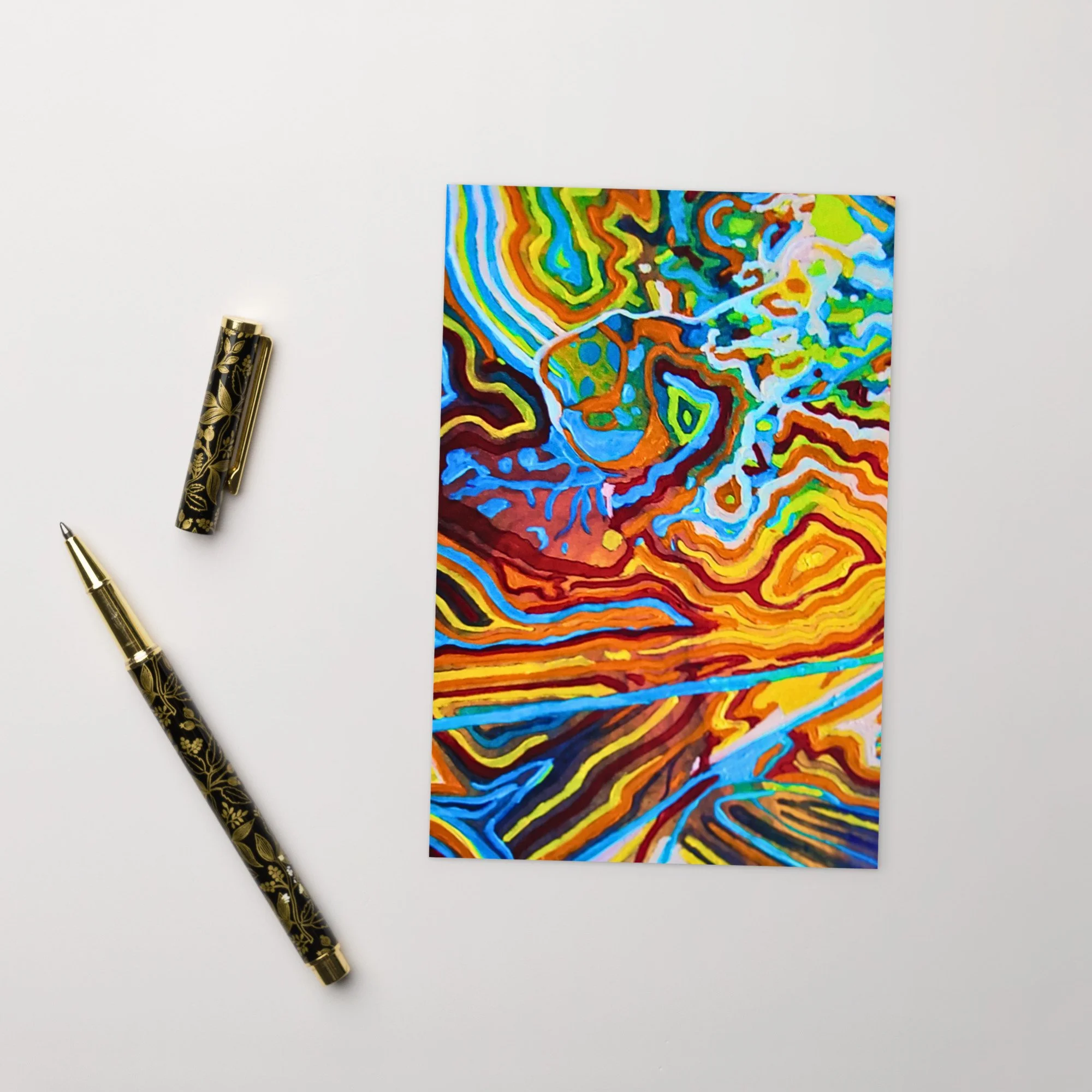
Electric yellows, molten oranges, deep oxides, and luminous blues flow across the composition like an aerial map of thermal terraces. Layered contour bands echo mineral deposits formed slowly over time, while bright turquoise pathways suggest runoff channels cutting through warm earth. The painting becomes an energetic cartography of water, heat, and motion.
Printed as a fine art postcard on thick matte paper, this piece offers a small, tactile way to hold the landscape. It can be framed, gifted, or sent as a thoughtful note.
Details
• Size: 4 × 6 inches (101 × 152 mm)
• Paper weight: 260–350 g/m²
• Paper thickness: 0.34 mm
• Coated outer surface
• Cardboard paper
• Blank product materials sourced from Sweden, US, Brazil, or China
Te Puia and the Living Tradition of Māori Arts
At Te Puia, the land speaks in steam and water.
The valley opens with rising mist and the steady presence of Pōhutu Geyser, sending columns of water into the air at its own rhythm. Mud pools turn slowly. The earth shifts and breathes beneath wooden walkways.
But Te Puia holds more than geothermal ground. Within the New Zealand Māori Arts and Crafts Institute, carving and weaving continue in steady hands. Patterns passed down are shaped again in timber and fiber. Each line carries memory. Each surface shows patience.
There is movement here in many forms. Water rising from deep below. Chisels tracing grain. Voices lifted in song during cultural performance.
You walk through heat and history at the same time. The landscape and the people remain closely tied, each shaping the other across generations.
Steam moves slowly through the valley at Te Puia. The ground releases warmth beneath each step, and the air carries the mineral scent of the geothermal earth. In the distance, geysers rise in quiet intervals, sending water and steam upward before settling again into stillness. Between these moments of motion, carved wooden meeting houses and workshops stand grounded in deep cultural tradition.

Te Puia and the Living Tradition of Māori Arts
Te Puia sits within the geothermal valley of Whakarewarewa in Rotorua, one of the most culturally significant landscapes in Aotearoa New Zealand. The land is closely connected to the iwi of Ngāti Whakaue, whose ancestors have lived among these geothermal springs for generations. Here, the earth’s geothermal energy has long shaped daily life. Hot pools were used for bathing and healing, while natural steam vents allowed food to be cooked within the ground itself.
At the heart of Te Puia stands the New Zealand Māori Arts and Crafts Institute, an institution dedicated to preserving and teaching traditional Māori art forms. Established in 1963, the institute was created to ensure that skills such as whakairo (wood carving) and raranga (weaving) would continue to be passed from master artisans to future generations.
Walking through the workshops, visitors can watch students and master carvers working slowly through large pieces of native timber. Every carved form carries meaning. Spirals represent ancestry and growth. Figures along the beams of meeting houses embody ancestors who continue to watch over their descendants. The work is patient and precise, shaped through years of training and cultural knowledge.
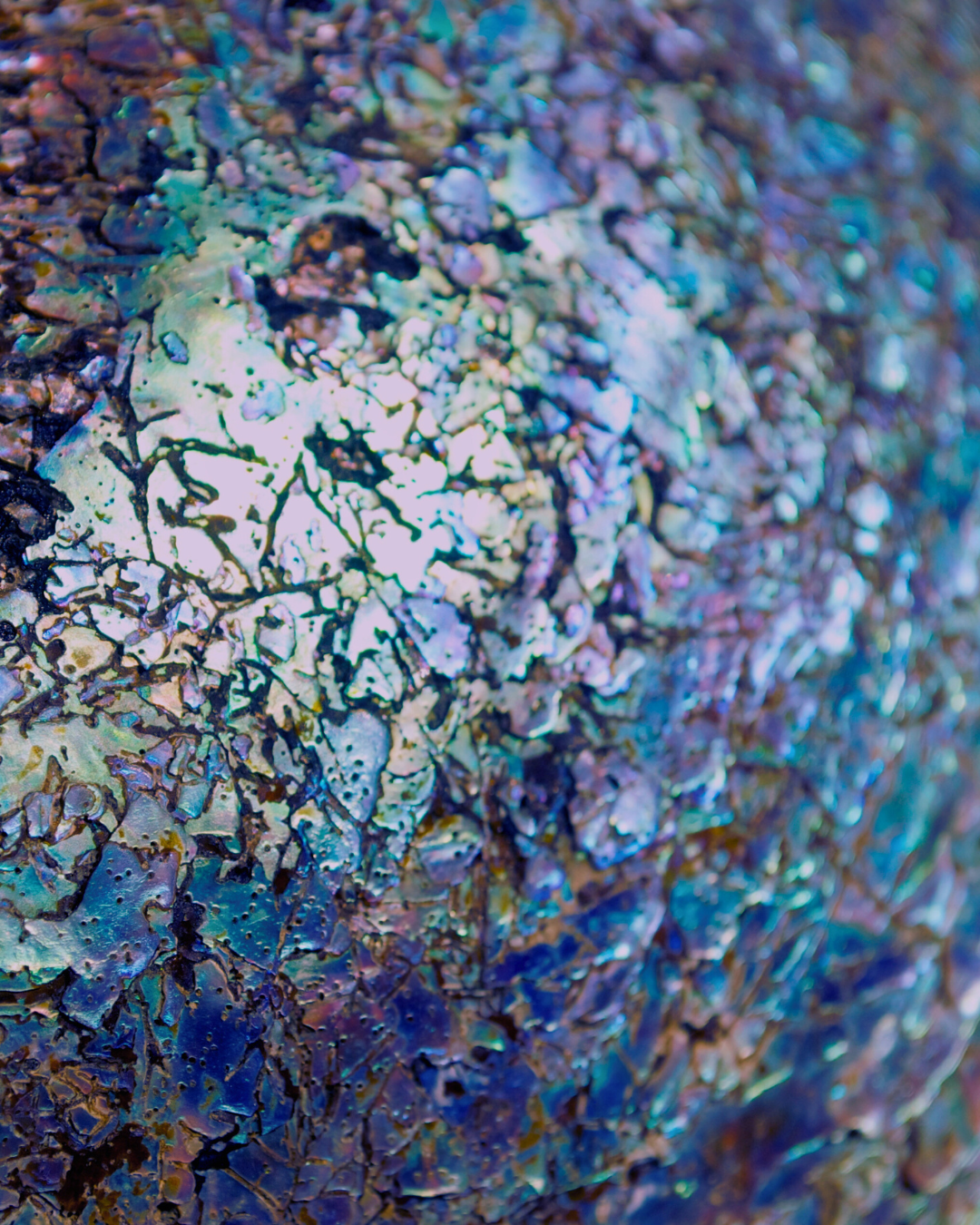
One of the most striking details within Māori carving is the use of pāua shell. These shells, harvested from coastal waters, are traditionally set into carved figures to form the eyes of ancestors and guardians. Their luminous surfaces shift between turquoise, deep blue, violet, and green depending on the light. In carving, pāua is not simply decorative. The shimmering shell gives the figures a sense of life and watchfulness, allowing the ancestors represented in the wood to feel present within the space.
The geothermal landscape surrounding the institute forms a dramatic natural backdrop. The Pōhutu Geyser, the largest active geyser in the Southern Hemisphere, erupts up to twenty times a day, sending steam and boiling water as high as thirty meters into the air. Its name means “big splash” in Māori. The geyser has erupted consistently for centuries, a reminder that the same geothermal forces shaping the valley remain active beneath the surface.
In this place, cultural practice and geology exist side by side. Carved meeting houses stand beside steaming vents. Workshops filled with chisels and wood shavings overlook mineral terraces and boiling springs. The landscape feels both ancient and ongoing.
Translating the Landscape Into Abstract Cartography
This painting was created as an abstract cartography of that experience. Rather than documenting the site literally, the work maps the sensation of being there.
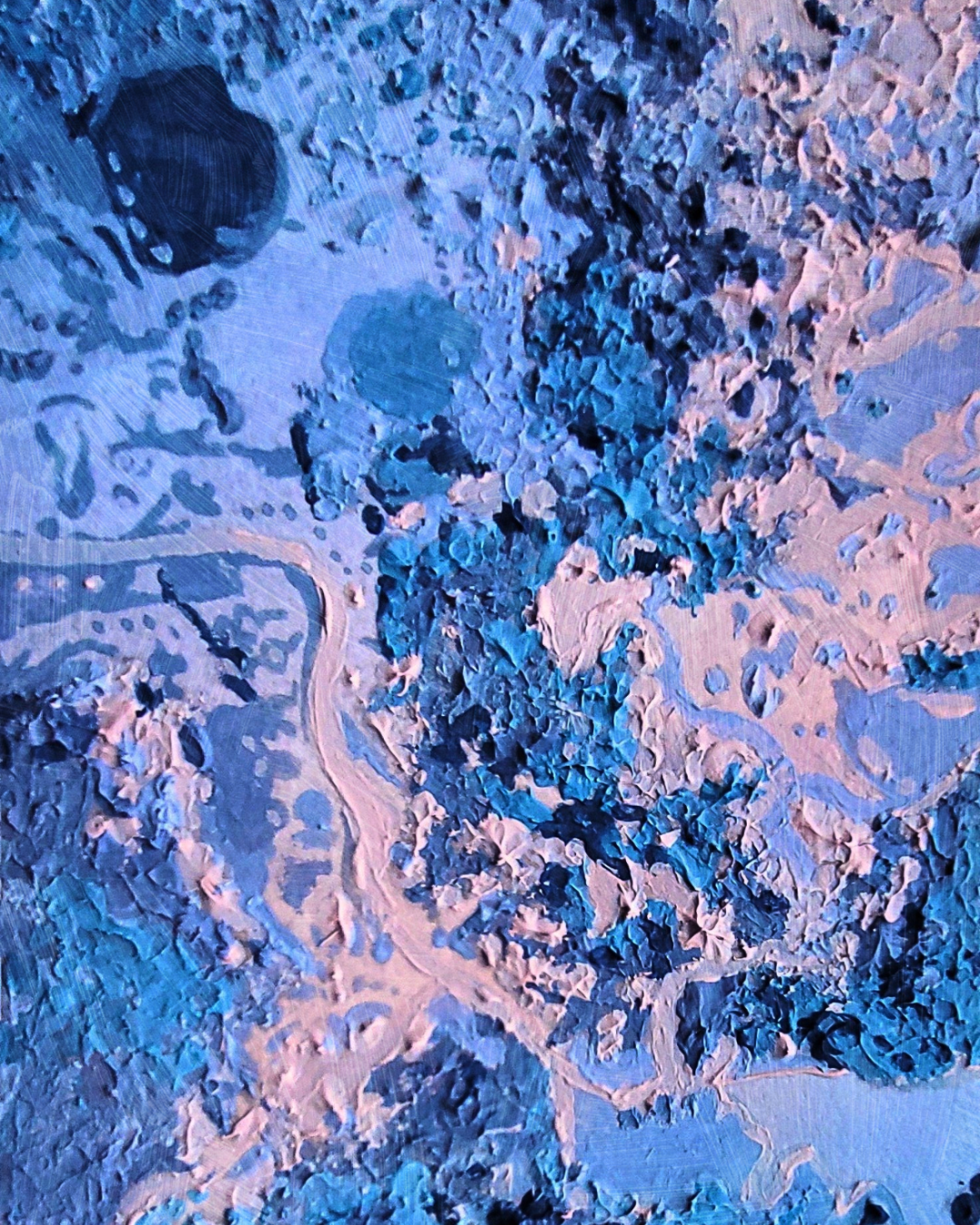
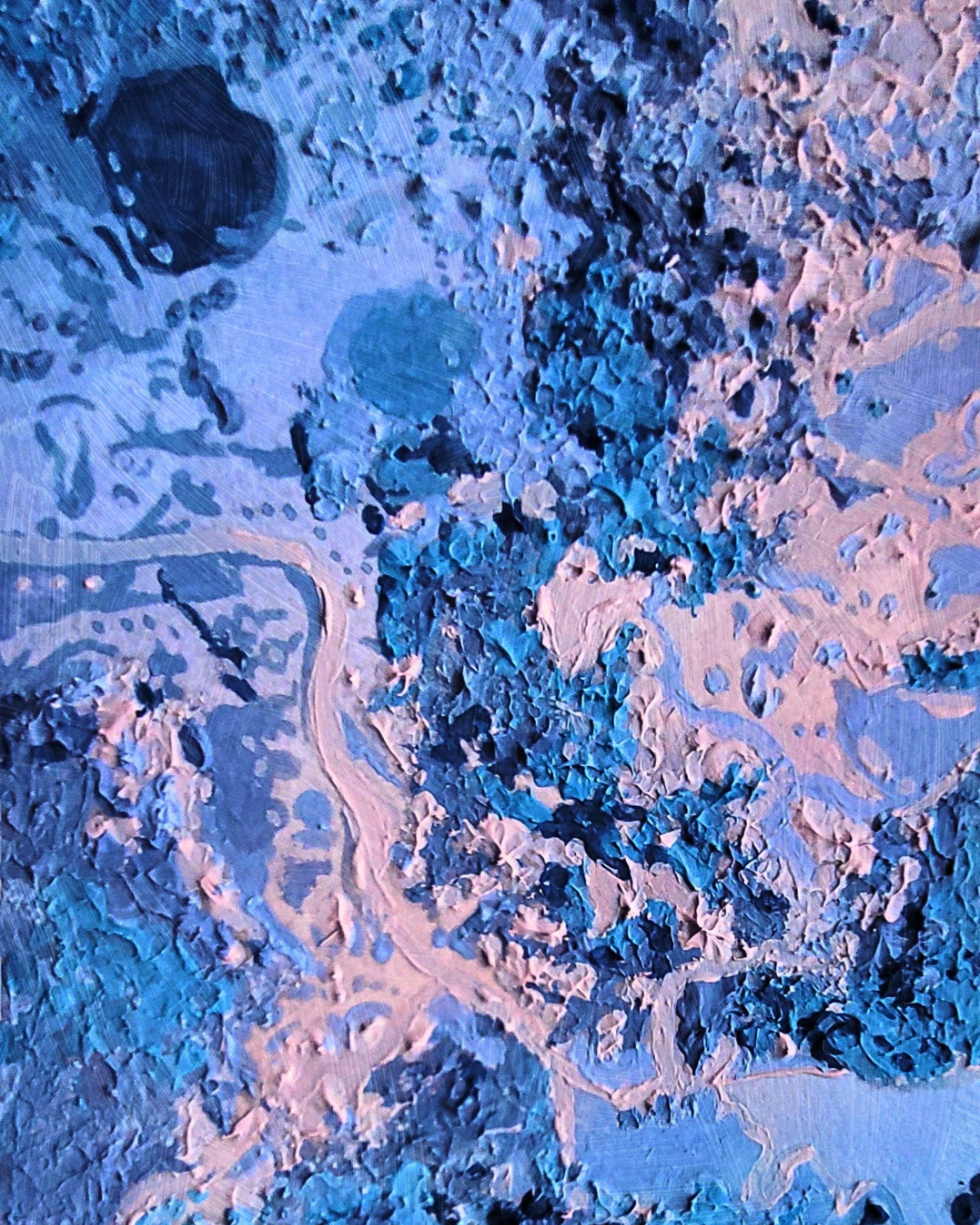
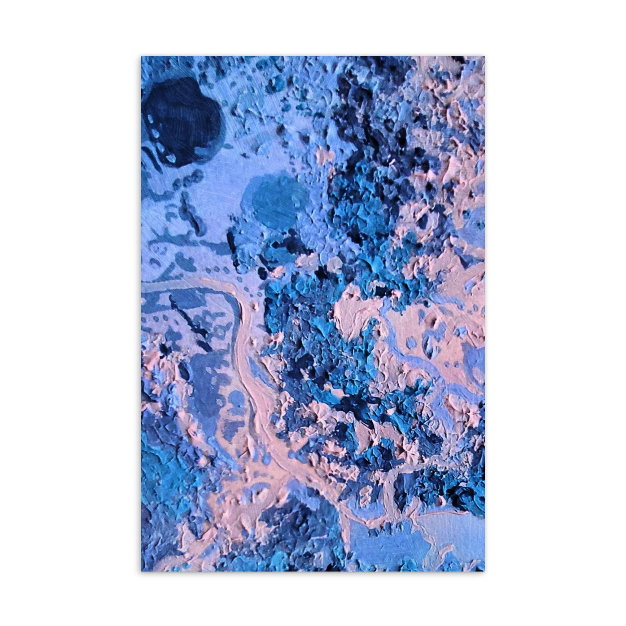
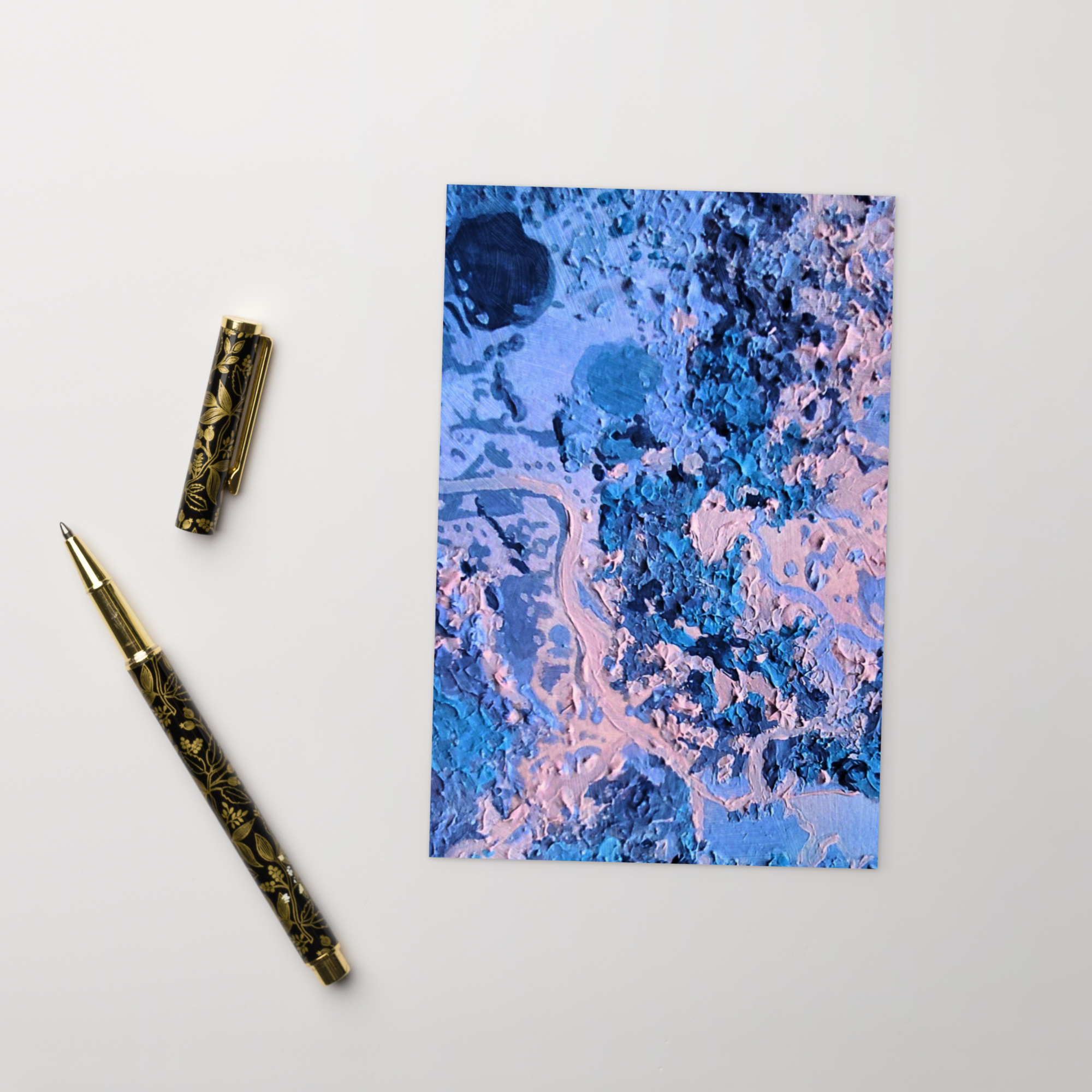
The painting reflects these experiences through layered blues, mineral pinks, and deep earthen tones. Thick, sculptural textures echo silica terraces and cooling lava. Pools of saturated blue suggest geothermal waters, while raised passages of paint resemble carved surfaces and woven fibres. Flowing, organic lines move across the canvas like steam drifting through the valley or like patterns emerging from whakairo. The composition feels immersive and tactile, mirroring the sensory intensity of Te Puia itself, where heat, history, artistry, and guardianship converge in one living landscape.
These tones were influenced by the iridescent surface of pāua shell used in Māori carving. The shifting blues and pinks of the shell appear unexpectedly within carved figures, catching light in a way that feels almost alive. In the painting, similar colors gather within the composition like pools of geothermal water or moments of reflected light moving across mineral surfaces.
Layered forms suggest both landscape and structure. Some shapes recall the rising steam of the valley, while others hint at the carved beams and symbolic motifs found within meeting houses. The composition slowly unfolds from a grounded center outward, much like the experience of standing between the carved architecture of the arts center and the living geothermal earth beyond it.
Collecting the Te Puia Artwork
• Cardboard paper
• Paper weight: 7.67–10.32 oz/yd² (260–350 g/m²)
• Size: 4″ × 6″ (101 × 152 mm)
• Paper thickness: 0.013″ (0.34 mm)
• Coated outer surface
• Blank product materials sourced from Sweden, US, Brazil, or China
Sweet Savannah: A Candy-Colored Love Letter
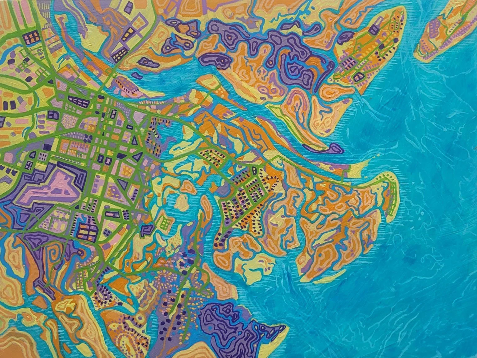
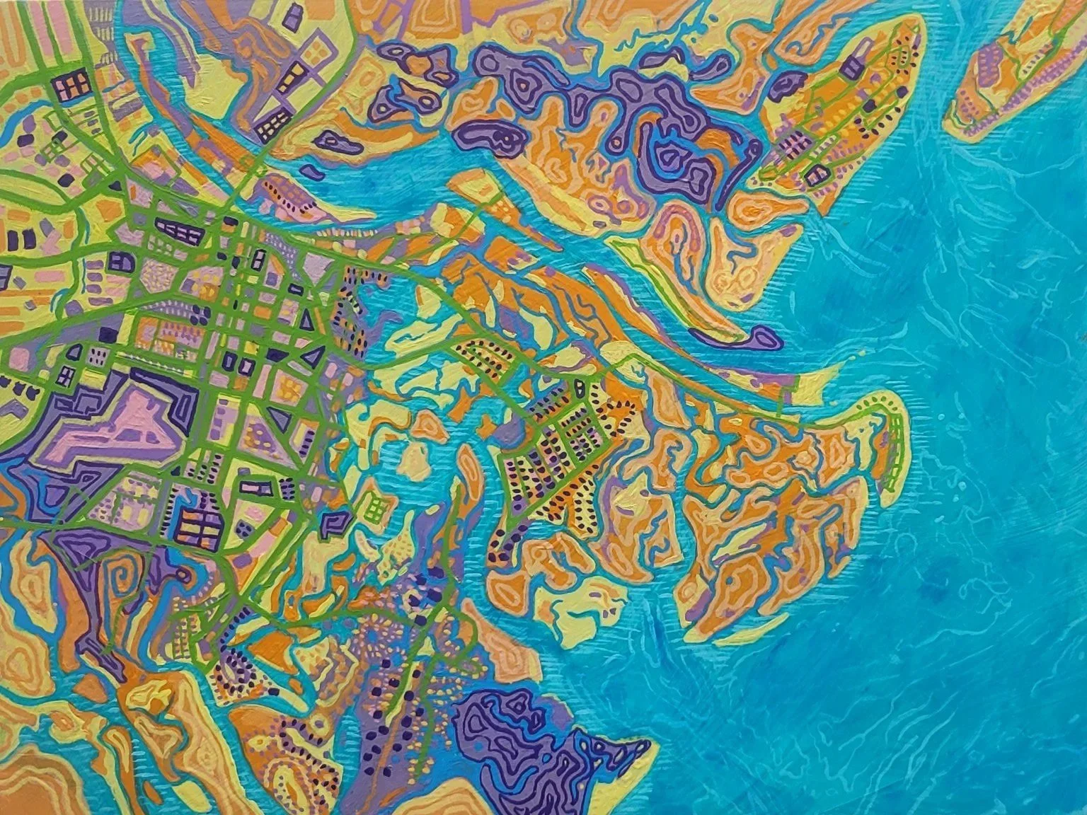
Inspired by the candy-colored world of River Street Sweets, Sweet Savannah transforms Savannah's iconic map into a vibrant celebration of memory, place, and wonder. From winding waterways and historic streets to the aroma of freshly made pralines, this artwork tells the story of a city that captured my heart during a magical first visit at sixteen years old.
In Sweet Savannah, I wanted to capture not only the geography of the city but also its flavor, its energy, and one of its sweetest traditions. Inspired by the vibrant colors, playful patterns, and irresistible confections of River Street Sweets, this painting transforms Savannah's map into a kaleidoscope of candy-colored memories.
At first glance, the painting appears abstract—a patchwork of turquoise waterways, lavender neighborhoods, lime-green streets, and swirls of golden marshland. But look closer and Savannah begins to emerge. The geometric street grid of the Historic District anchors the center, while the rivers, marshes, islands, and coastal waterways spread outward in organic patterns. The map becomes both recognizable and dreamlike, much like Savannah itself.
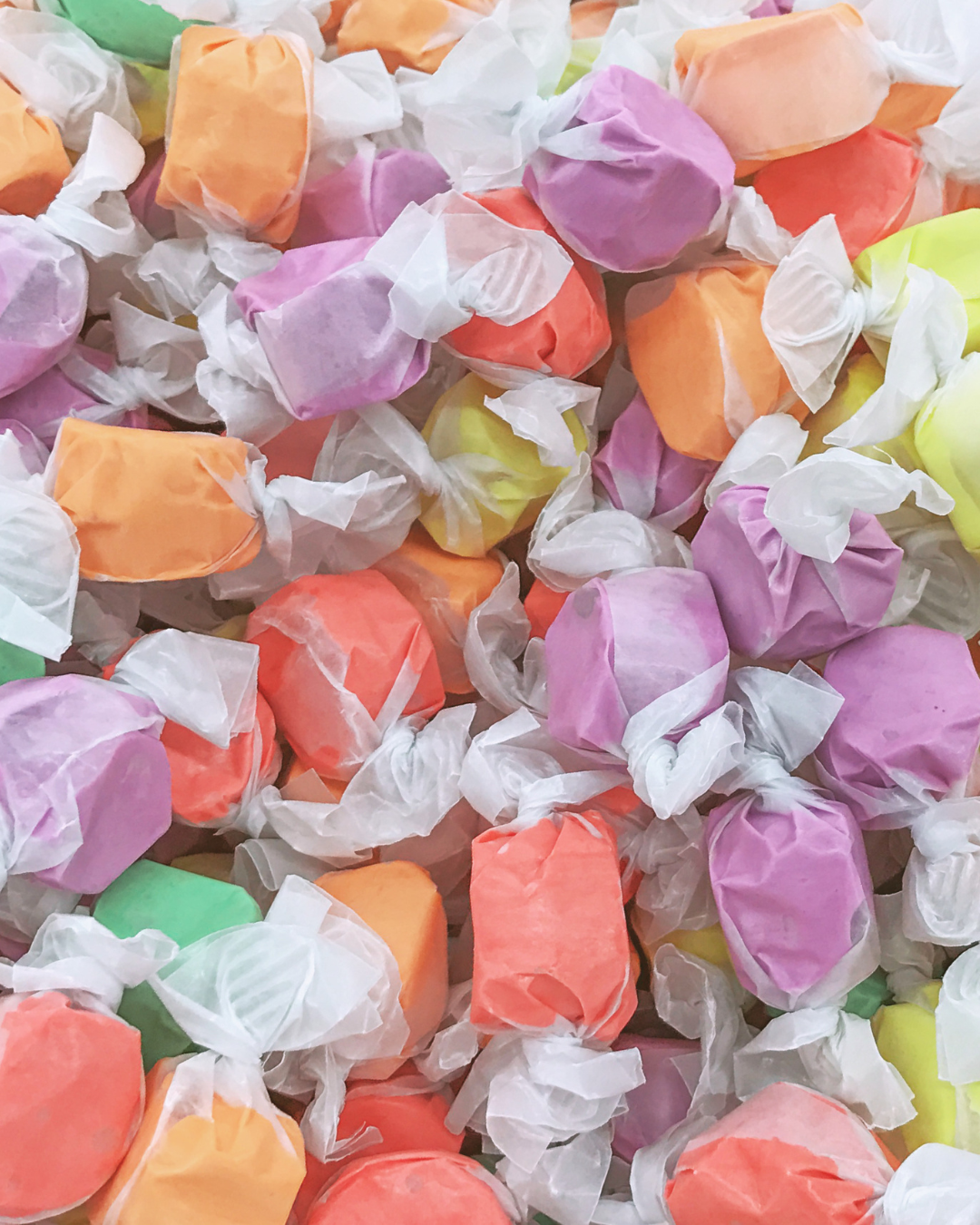
The color palette came directly from memories of stepping into River Street Sweets. The creamy yellows evoke pralines fresh from the kettle. Bright turquoise reflects the Savannah River and coastal waterways. Lavender and purple echo candy wrappers and saltwater taffy. Every color choice was intended to feel delicious.
My First Visit to River Street Sweets
I still remember my first visit to River Street Sweets when I was sixteen years old, though it felt like I had wandered into a storybook candy shop from another time.
I was walking along Savannah's River Street, watching giant ships glide by on the river, when something magical happened. A sweet smell drifted through the air and wrapped around me like an invisible ribbon. It smelled like warm butter, toasted pecans, vanilla, and bubbling sugar. I followed it without even thinking, as if the scent itself was leading me on an adventure.
Before I knew it, I was standing in front of River Street Sweets.
The moment I stepped inside, the whole world seemed brighter.
Copper kettles sparkled under the lights. Candy makers stirred and scooped sweet treasures behind shiny marble counters. Mountains of colorful treats filled every corner. Fresh fudge rested on cooling slabs, and everywhere I looked there was something delicious to discover. It felt less like a store and more like a candy wonderland.
Then came the moment I'll never forget.
Someone handed me a warm praline sample.
I took a bite and everything stopped.
It was soft and creamy, sweet and buttery, filled with crunchy Georgia pecans. It tasted like sunshine and Southern hospitality all wrapped into one little candy. I remember thinking that it was the most wonderful thing I had ever tasted. And honestly, I've been hooked ever since. Pralines became my favorite sweet treat that day and remain my favorite to this day. No matter where I find them, they always take me back to that first visit—to the smell of caramelized sugar in the air, the gleam of copper kettles, and the feeling of discovering something magical on Savannah's River Street.
Years later, that memory still makes me smile.
When I created Sweet Savannah, I wanted to capture that feeling—the excitement of discovering something magical, the swirl of colors, the sweetness in the air, and the joy of seeing Savannah through wide-eyed wonder. The candy-colored patterns in the painting are inspired by those memories, and every winding waterway and bright street carries a little piece of that sixteen-year-old girl who followed the smell of pralines into a place she would never forget.
The Sweet Story of River Street Sweets
River Street Sweets began in 1973 on Savannah's historic waterfront and remains the city's oldest candy store. The business grew from a family gift shop called The Cotton Bale, operated by the Strickland family. What started as a small venture evolved after the family began making fudge in the store, experimenting with recipes, and eventually perfecting what would become their signature pralines.
The story of the pralines includes a happy accident. During one of the first batches, the marble slab used for cooling wasn't prepared properly, causing the candy to crumble into small pieces. Rather than waste them, founder Stan Strickland handed the broken bits out as samples. Visitors loved them, and the tradition of free praline samples became part of the River Street Sweets experience.
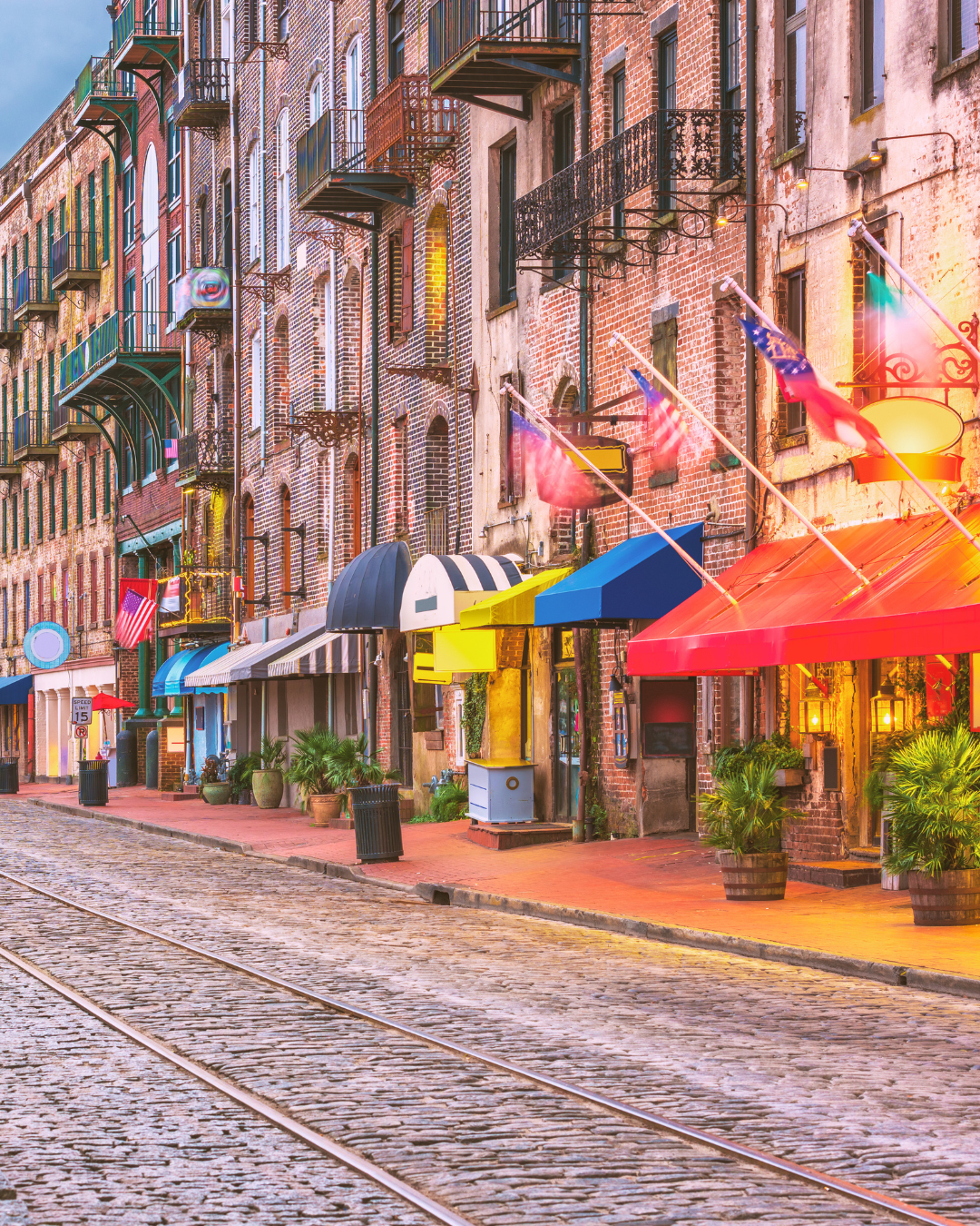
The company's success mirrors the transformation of Savannah's waterfront itself. When River Street Sweets opened, River Street was far from the bustling destination it is today. Through decades of revitalization and investment, the waterfront became one of Savannah's most beloved attractions, with River Street Sweets serving as one of its enduring landmarks.
Today, the company continues to be operated by members of the Strickland family and has expanded beyond Savannah while maintaining its roots in Southern hospitality and traditional candy making.
Painting a City Through Flavor
What fascinates me about maps is that they hold stories. Streets become memories. Rivers become journeys. Neighborhoods become historical moments.
In Sweet Savannah, the map serves as a framework, but the real subject is nostalgia.
The turquoise waterways recall summer afternoons along the river. The golden and cream-colored landforms reference pralines cooling on marble slabs. The bright greens of the street grid create the structure of Savannah's famous city plan, while the playful patterns mimic the joyful abundance found inside a candy store.
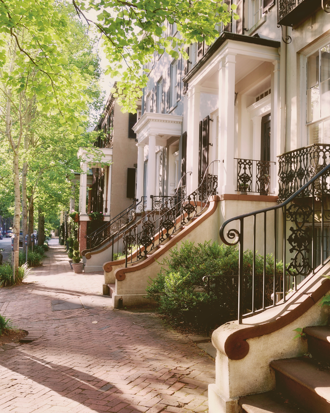
Much like River Street Sweets, Savannah balances history and whimsy. It is a city where eighteenth-century streets meet modern creativity, where centuries-old architecture sits beside colorful storefronts, and where a simple candy recipe can become part of a city's identity.
For me, Sweet Savannah is a celebration of that spirit—a map infused with memory, color, and sweetness. It is a tribute to a city I love, to a candy shop that made a lasting impression on a sixteen-year-old visitor, and to the idea that sometimes the best way to remember a place is through the flavors, colors, and stories that stay with us long after we've gone home.